

Geocode with Nominatim#
Convert an address or place name to geographic coordinates and a bounding box using the OpenStreetMap Nominatim API.
Inputs:
Address / Place Name. Address or place name to geocode, e.g.
Basel, SwitzerlandorMarienplatz 1, München;Buffer (km). Expand the bounding box by this distance in km (default: 0). Useful to create a working area around a point address.
Outputs:
JSON string with west, south, east, north — directly usable as bbox input for other tools;
Human-readable geocoding result summary;
Full JSON manifest with coordinates, bbox, area, and metadata.
Launch the tool: https://toolbox.nextgis.com/t/nominatim_geocode
Example:
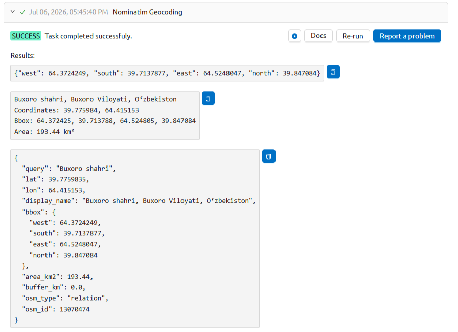
Fig. 215. Example output#
Try the tool in action
Click on the Demo button above the tool form. The fields are filled in with demo values.
Click on the Run button.