Set of squares with transects#
This tool creates a set of square grids (polygons) and a transect for the territory.
Inputs:
Coordinates of the first point (center of the first cell), in decimal degrees, example
40.415378, -3.688743;Coordinates of the second point that indicates direction, in decimal degrees, example
40.417436, -3.683170;Side - on which side to generate the grid: right or left;
Cell count 1 - Number of cells on the first axis;
Cell count 2 - Number of cells on the second axis;
Cell size - The size of a cell’s side, in meters.
The result of the process is a set of layers:
rect1 - a grid of cells “Size 1” by “Size 2”, the center of the first cell is at the point 1;
rect2 - a grid of smaller cells (i.e. each large cell is divided into 4 parts);
line1 - transect lines in the direction perpendicular to the line between points 1 and 2;
line2 - transect lines in the direction parallel to the line between points 1 and 2;
centers - cell centers of rect1 grid.
Styles for all the layers are also included as QML files.
Launch the tool: https://toolbox.nextgis.com/t/quadro
View the results on an interactive map: https://demo.nextgis.com/resource/4582/display?panel=layers
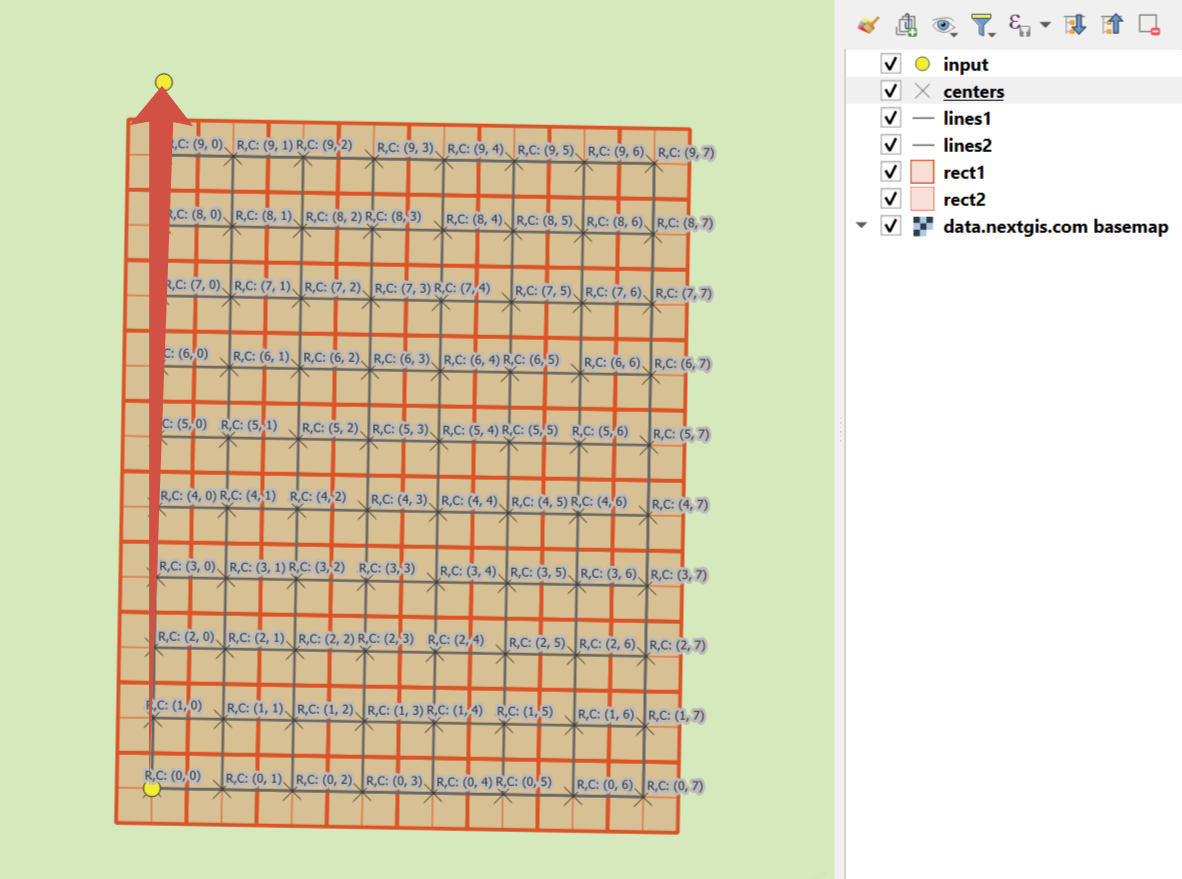
Fig. 199. An example of the results#
Try the tool in action
Click on the Demo button above the tool form. The fields are filled in with demo values.
Click on the Run button.