General Information#
NextGIS Web is a web mapping application designed to store, manage access and visualize geographic data.
NextGIS Web is open source software. NextGIS Web supports Open Geospatial Consorcium (OGC) open data exchange protocols and meets the modern requirements for application architecture implemented on the basis of free software (Open Source).
NextGIS Web allows:
Creation and display of maps.
Map navigation (zooming, shifting).
Manage the map through web-interface.
Vector (ESRI Shape, PostGIS etc) and raster data import.
Manage access rights for layers, groups of layers, maps and other resources.
Interaction through API.
Watch on youtube.
NextGIS Web has server and client sides.
Server side stores and renders geodata. It’s written in Python using Pyramid framework. Client side is a user interface for interactive geodata management as maps and separate resources.
Client is written in JavaScript. System’s configuration is stored in a PostgreSQL database with a PostGIS extension. Page markup for user interface is written using HTML. Style for user interface is added using cascading style sheets – CSS. Queries to databases use SQL language.
NextGIS Web is a modular system with several core modules and extensions. Extensions could be enabled or disabled at the application configuration step. NextGIS Web components communicate with each other using internal API methods.
NextGIS Web is designed to operate in Linux operating system environment (Debian-based distributives are recommended, e.g. Ubuntu Server). Read more in section Recommended software versions. NextGIS Web client-side works in all modern browsers. User interface with a published Web Map is shown on Fig. 247..
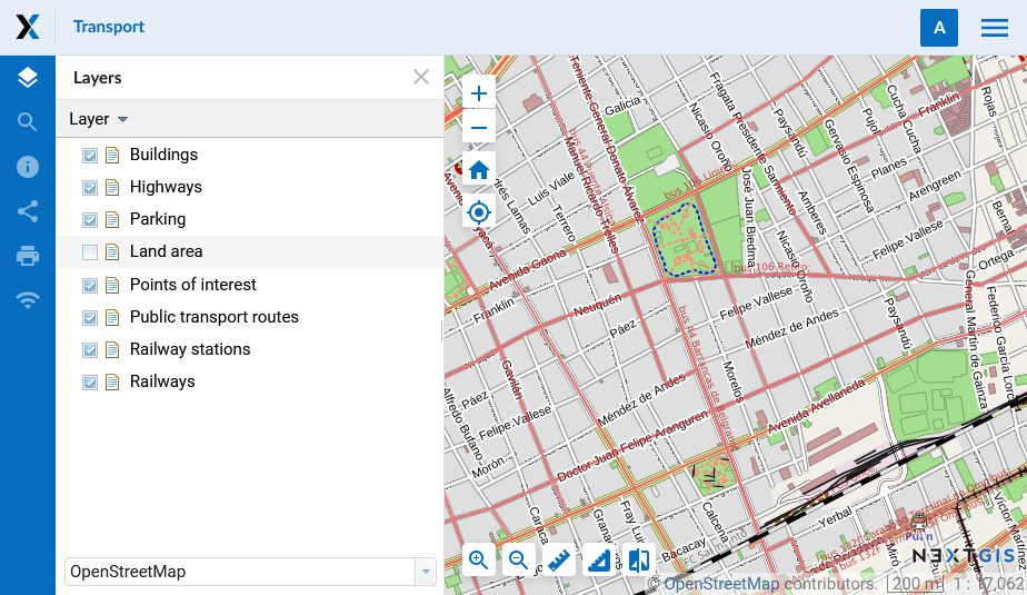
Fig. 247. User interface with a published Web Map#
Key features of NextGIS Web#
NextGIS Web has the following key features:
Data layers#
Creation of raster and vector layers and data upload for them using web interface.
Creation of WMS and TMS layers and connections to existing services.
Creation of PostGIS layers and connection to layers in external databases.
A set of standard basemaps: OpenStreetMap and others from QuickMapServices.
WFS service.
WMS service.
Dictionary (with extension).
File set.
“Key-value” function, support for metadata.
Export to various formats (see full list here).
Access management#
Detailed settings of access rights for each connected layer.
Setting of access rights for resources and resource groups.
Rendering and symbology#
Web Maps#
Own set of layers and layer tree management for each map.
Reuse of the same layer representation in different maps.
User interface#
Layer tree.
Layer groups.
Navigation tools panel.
Search by attributes.
Bookmarks for fast access to some regions of the map.
Layer description view.
Feature table view for layer with fast switch between a table and a map.
Annotations.
Editing#
Editing of feature attributes.
Editing of layer description.
Adding of photos and other attachments.
Editing features with WFS-T.
Minimum hardware#
Minimum hardware requirements for NextGIS Web software:
4 vCPU
8 GiB of RAM
250 GB HDD (SSD would be much better)
Recommended software versions#
Recomended browsers are:
Google Chrome (version 118 or newer)
Mozilla Firefox (version 115 or newer)
Edge (version 116 or newer)
Safari (version 17 or newer)
Opera (version 104 or newer)
Microsoft Internet Explorer browser is not suppoted.
Warning
NextGIS Web would probably work with other versions, but this is not garanteed.
Technical requirements for on-premise installations are listed here.