User interface#
NextGIS Tracker app has two principal screens:
Main screen;
Settings screen.
Main screen#
The main screen of the app is shown on Fig. 1085..
Fig. 1085. Main screen#
The main screen shows information about track recording.
In the Current location section:
Information about the track in progress (if GPS is available);
No information about the track in progress (no GPS access);
In the Status section:
If no recording is in progress, the message is: “Stand by. Tap Start to start collecting tracking data.”;
If a recording is in progress, the message is “Collecting tracking data and syncing …”;
In the Tracks section:
If you have recorded tracks, they are shown in this section. Tracks can be exported to GPX file;
If there are no tracks, the section is empty;
Button that starts/stops track recording.
Settings#
Tap the menu button in the top right corner of the app screen, then select “Settings”.
Settings screen is shown on Fig. 1086..
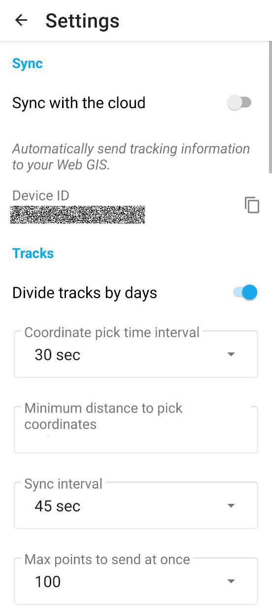
Fig. 1086. Settings screen#
On the Settings screen you can configure the following parameters:
In the Sync section:
“Sync with the cloud” - enable or disable synchronization with Web GIS;
“Device ID” - copy the ID of your device;
In the Tracks section:
“Divide tracks by days” - at midnight the current track stops and a new one begins;
“Coordinate pick time interval” - how often the app detects and records coordinates. Select from a dropdown list an interval between 1 second and 45 min.;
“Minimum distance to pick coordinates” - select the smallest change in distance to be marked as a new location (1-300 m);
“Sync interval, sec” - select from a dropdown list how often to synchronize tracks with Web GIS (min 1 sec., max 45 min.);
“Max points to send at once” - select from a dropdown list a number between 1 and 300.