Convert EGRN KPT to geodata
Initial and resulting data
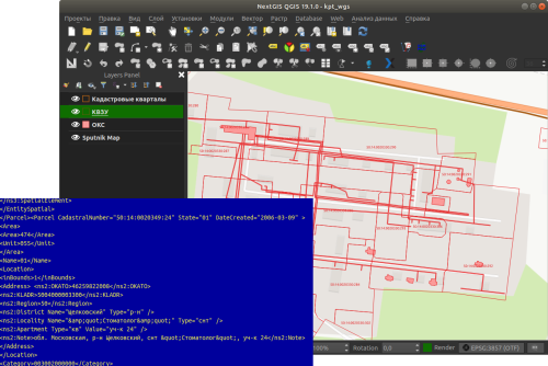
The tool converts one or several Rosreestr KPT from XML format into a convenient geodata format with a GIS project.
Inputs:
Zip archive with zip archives of Rosreestr downloads (archive of archives with the name format Response-80-105152635.zip)
Output geodata format - GeoJSON, ESRI Shape, MapInfo TAB
Outputs:
zip archive with the QGIS project and geodata
The archive contains directories: a geodata directory in the original coordinate system, a geodata directory in EPSG: 4326 (wgs) and a project for QGIS with data in EPSG: 4326 with the design.
A description of the layers is given at https://data.nextgis.com/en/cadastre/#region-layers
Launch the tool: https://toolbox.nextgis.com/t/pkk_kpt
Try the tool in action
Click on the Demo button above the tool form. The fields are filled in with demo values.
Click on the Run button.