Generate an image of a cadastral parcel by number
A tool for generating an image of a cadastral parcel using its number from nspd.gov.ru.
Inputs:
Cadastral number in
06:07:0400001:414or06:07:0400001format.Object type. Available values are: 1 - parcels, 2 - units, 4 - area, 5 - buildings, 10 - restricted zones.
Image width - width of the output image in pixels (default: 827).
Image height - height of the output image in pixels (default: 583).
Fill color. Accepts HTML color names or HEX format (e.g.,
orange,#FFA500). Default: red.Fill opacity for the object. Between 0 (transparent) and 1 (opaque), with decimal point, the default value is 0.6.
Stroke color - color for the object outline. If not specified, the fill color is used. Accepts HTML color names or HEX format (e.g.,
orange,#FFA500).Stroke opacity. Between 0 (transparent) and 1 (opaque), with decimal point, the default value is 1.
Stroke width in pixels, the default value is 1.
QMS ID - ID of a basemap service in NextGIS QMS catalogue (QuickMapServices - https://qms.nextgis.com) to use for the map background. If not specified, defaults to OpenStreetMap. Example:
1300– Satellite imagery,519– Topographic map.
Maximum zoom level used when fitting the layer (default: 18). Valid range: 0 (world view) to 22 (building-level detail). * Padding around the fitted layer in pixels (default: 5),
Output:
PNG image.
Launch the tool: https://toolbox.nextgis.com/t/cadastre2img
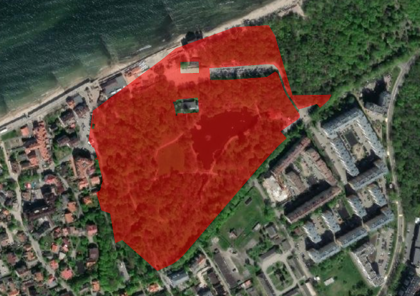
An example image generated by the tool
Try the tool in action
Click on the Demo button above the tool form. The fields are filled in with demo values.
Click on the Run button.